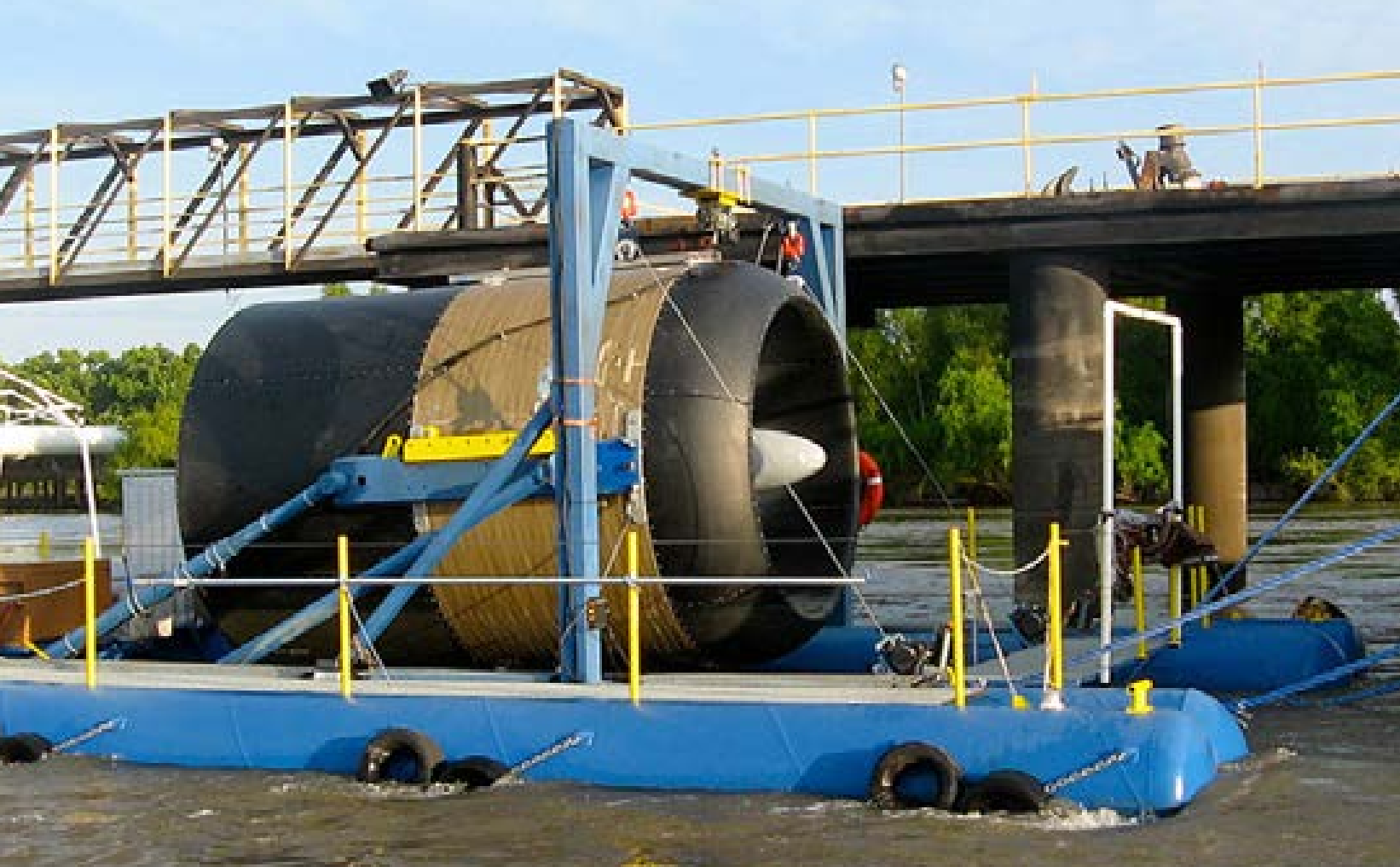
Free Flow Power near Baton Rouge
In 2011 Free Flow power deployed their SmarTurbine in the Mississippi River near Baton Rouge Louisiana. The deployment lasted for six months and had several goals such as;
- Operational Verification which monitored the SmarTurbines cut-in speed, power generation and reliability.
- Performance Testing which monitored the SmarTurbines performance coefficient, temperature rise, and drag.
- Site Characterization which monitored the rivers seasonal velocities, entrained debris, fish safety, and water traffic.
The project was initially hailed as a large success leading to the company either planning for or even directly obtaining permits for 65+ deployments. The top 25 sites alone were expected to bring in 3 MW of power, reaching 5+ MW with the inclusion of up to 40 sites. While concern was raised about the impact to fish in the river, studies at the time indicated that no harm came to fish from the turbine. For deployment of these turbines along the length of the Mississippi river, large shafts were to be driven into the river bedrock which the turbines would attach to at specific heights. While the project was initially deemed feasible, reports indicate that a later fall in electricity costs made the project financially infeasible. Additionally a drought dropped water levels to record lows, calling into question the mounting method for the turbines and their impact to river traffic. The larger deployment eventually stalled and ended with Free Flow returning their permits for the deployment locations.
- Riverine
This Project has the following MRE Devices
Filters:
Citation Formats
“Free Flow Power near Baton Rouge.” Marine Energy Projects Database: Projects, PRIMRE, United States Department of Energy, https:https://openei.org/wiki/PRIMRE/Databases/Projects_Database/Projects/Free_Flow_Power_near_Baton_Rouge. Accessed <day> <monthRoman> <year>.
Marine Energy Projects Database: Projects. <year>. "Free Flow Power near Baton Rouge." Accessed <monthRoman> <day>, <year>. https:https://openei.org/wiki/PRIMRE/Databases/Projects_Database/Projects/Free_Flow_Power_near_Baton_Rouge.


